Participating in architectural surveys in Villa Domitian in Castel Gandolfo, I have had chance to spend a fair share of time running around there. We have been staying in Miralago Hotel [1]. The food there was amazing and so were the trails around as well. Working as surveyor is a challenging job – you have to be on your feet all day long, and in some cases you have to walk around a lot as well. I particularly enjoy the long walks/expeditions. I felt like a child again, searching for ancient remains – just like we used to look for hidden treasure. And the joy of each finding was the same as it was back then. If you switch on this Columbus-mode once, I find it impossible to switch it off again. So, I have kept my eyes open on all runs and it made my adventures more exciting.
The Albano mountains are a vulcanic mountain range, composed out of four/five large craters of which two are filled with water – Albano Lake and Nemi Lake. This area has been very popular as a recreational spot for Romans since ancient times when the emperors and senators used to build here their villas (like the one we have been working on). There are several paths, see the plan attached below, to go for a run or ride but be prepare, the marking system is poor – especially comparing it to the one in central Europe. I will attach to each route a GPX-file.

Plan of paths in the Albano Mountains – plan found on the information panel.
I will pick the most interesting runs for you and attach some pictures to them as a little motivation of what to expect on your way. However, I find it very limiting to try and squeeze two months of experience into one post, so I hope to do my best.
1st – ONCE AROUND ALBANO LAKE (10km)
I believe this is a must. It is the easiest one so even with people of lower fitness level will have no problem managing it. I have been running this one in several variations, you can simply go once around the lake or park your car on the edge of caldera, e.g. in Castel Gandolgo or at Trattoria Le Fratte Ignoranti [2]. However, the vertical connection between lake and caldera edge is due to steep hills very rare. You can chose from two roads with traffic and one trail. There should be a second trail as well, yet I have lost it in woods and had to find my own way. I would not recommend to do so in all parts! You can easily find yourself standing of high crag.
The trail around lake runs halfway in woods, yet you would find several spots where you can enjoy the view over lake and Castel Gandolfo. It is quite popular with bikers as well. What is more, this spring they have been secured the flying rocks from the steep hills around the whole crater, so it should be safe. Unfortunatelly, a part of the route follows the street and the promenade along the coastline, so you would find yourself running on hard surface.
GPX-file (link)
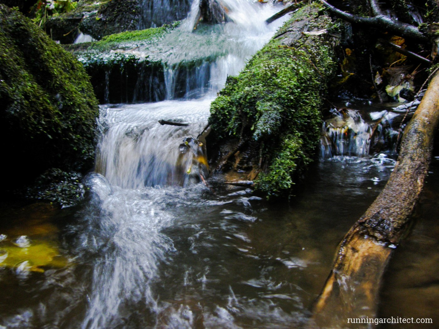
2nd – AQUADUCTS and water (5-10km)
If you are passioante about antique ruins, you should definitely check this one out. The best starting point is the Trattoria Le Fratte Ignoranti. I would highly recommend this place as a great starting point for several routes, there are some parking lots (free of charge) and you can get a nice lunch afterwards as well. The pizza is so delicious! 🙂
..to be continued.
GPX-file (link)
3rd – MONTE CAVO (5-20km)
If you like great view, make sure you do not miss this one. Monte Cavo is the second largest hill in Albano mountains. I have made it up there several times, mostly for the sunset. You can run up there along the Via Sacra or you can bike on them modern road (cars are also not banned but I will not support this option 🙂 ).
…
GPX-file (link)
4th – NEMI LAKE
After discovering pathes around Albano Lake in September 2014, I was very excited to get to Nemi lake in spring 2015. I have to say, I was fitter and more enthusiastic about exploring on foot then. Nevertheless, if you will be longing for a nice stroll or run around the lake, you will be disappointed. Unfortunatelly, there is no path along the coastline. You can take a path descending from Nemi – either the steep one or along the modern road. They both lead to the Museum (Museo navi romane – exhibiting an acient boat which was found in Nemi lake and some more) but thats it. There is no beach and I was having hard time getting to the water in general, so no swimming either. The northern part of crater is blocked by agricultural activity and the few settlements. To be honest, I only liked this lake from caldera edge.
no separate GPX-file
5th ALL IN ONE (30+ km)
….
GPX-file (link)
[1] Hotel Miralago, Albano Laziale, Rome: http://www.miralago-hotel.it/
[2] Trattoria Le Fratte Ignoranti: http://www.lefratteignoranti.it/info__contatti.html
41.734046 N, 12.666277 E
GALLERY